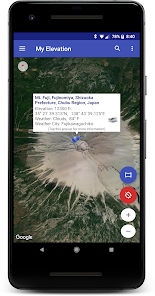
My Elevation

Advertisement
1M+
Installs
RDH Software
Developer
-
Productivity
Category
-
Rated for 3+
Content Rating
-
rdhsoftware@gmail.com
Developer Email
-
https://rdhsoftware.com/privacy/my_elevation_privacy_policy.html
Privacy Policy
Advertisement
Screenshots
editor reviews
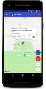
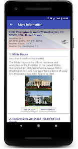
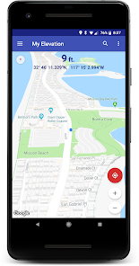
🌄 'My Elevation' app by RDH Software has carved its niche as a handy tool for outdoor enthusiasts 🏞️, travelers 🚗, and professionals 🏗️ who frequently need to ascertain altitude data. This app stands out for its precision 🎯, user-friendly interface, and uniquely practical features for elevation measurement. Unlike its counterparts, its simplicity and accuracy make 'My Elevation' a go-to choice for those who prefer real-time data without the frills. Particularly useful for hikers 🥾 who need to gauge elevation gain or engineers 👷 who require topographical data, this app efficiently delivers where others may fall short with overly complex features. The integration of GPS technology ensures that you are provided with up-to-date elevation statistics 📊, regardless of where you are. Moreover, adding a personal touch, it allows you to share your elevation findings with friends or on social media platforms 📲, enhancing your shared experiences. So why settle for less when you can have the heights at your fingertips? Join the high-fliers 🚀 and download 'My Elevation' now to start your ascent to clearer elevation data!
features
- 📍 Precise GPS-based Elevation Readings - Incorporates GPS to deliver accurate altitude information essential for numerous outdoor and professional activities.
- 🔗 Social Sharing Feature - Enables users to share elevation details effortlessly with friends or on social media, adding a social facet to the experience.
- 📈 Historical Elevation Data - Access to elevation changes over time, beneficial for analyzing patterns or planning purposes.
pros
- 🤩 Intuitive Interface - Boasts a clear and easily navigable interface, reducing the learning curve and enhancing user engagement.
- 🤖 Offline Functionality - Provides elevation data without the need for a constant internet connection, ideal for remote locations.
- 🔍 Detailed Topographical Information - Offers comprehensive altitude details, supporting professionals in various fields with their specific needs.
cons
- 📶 Dependence on GPS Signal - Requires a reliable GPS signal, which can be a limitation in certain geographic areas or conditions.
- 🔋 Battery Usage - Due to the reliance on GPS technology, the app can consume significant battery life during prolonged use.
- 🌍 Limited by Geographic Availability - Some features may not function equally well globally, depending on regional GPS support and data.
Advertisement
Recommended Apps
![]()
Garanti BBVA Mobile
T. Garanti Bankasi A.S.4.6![]()
Calcy IV - Fast IV & PvP Ranks
TesMath4.6![]()
Thermometer - Indoor & Outdoor
Trajkovski Labs3.6![]()
Compass & Altimeter
PixelProse SARL4.6![]()
Omio: Europe & U.S. Travel App
Omio4.5![]()
Vans Family
VF Corporation4.7![]()
Watch Duty (Wildfire)
Watch Duty4.6![]()
America's Got Talent on NBC
NBCUniversal Media, LLC4.2![]()
Norton Secure VPN: WiFi Proxy
NortonMobile4.3![]()
GEICO Mobile - Car Insurance
GEICO Insurance4.6![]()
T.J.Maxx
The TJX Companies, Inc3.8![]()
Background Eraser - Remove BG
Photo Editor & Collage Maker4.9![]()
HIDIVE: Stream Your Anime!
HIDIVE, LLC2.2![]()
HeeSay - Blued LIVE & Dating
iRainbow4.1![]()
CASTify TV Cast for Chromecast
TV Cast0
You May Like
-
![]()
Grok
xAI4.9 -
![]()
White Noise Baby
TMSOFT4.5 -
![]()
Pearltrees
Pearltrees4.5 -
![]()
DigiCal Calendar Agenda
Digibites4.5 -
![]()
PicSay - Photo Editor
Shinycore4.1 -
![]()
Quit Tracker: Stop Smoking
despDev4.6 -
![]()
Music Player for Android
Leopard V74.6 -
![]()
TCP Humanity
TCP Software4.9 -
![]()
Plastic Surgery Simulator Lite
Kaeria3.2 -
![]()
Guitar Tuner Pro: Music Tuning
MWM - Music and creative apps for Android4.3 -
![]()
SimSimi
SimSimi Inc.4.3 -
![]()
SHOWTIME
Showtime Digital Inc.3.3 -
![]()
Gospel Living
The Church of Jesus Christ of Latter-day Saints0 -
![]()
Urbanspoon Restaurant Reviews
Zomato2.7 -
![]()
[adult swim]
[adult swim] games3.3
Disclaimer
1.Apponbest does not represent any developer, nor is it the developer of any App or game.
2.Apponbest provide custom reviews of Apps written by our own reviewers, and detailed information of these Apps, such as developer contacts, ratings and screenshots.
3.All trademarks, registered trademarks, product names and company names or logos appearing on the site are the property of their respective owners.
4. Apponbest abides by the federal Digital Millennium Copyright Act (DMCA) by responding to notices of alleged infringement that complies with the DMCA and other applicable laws.
5.If you are the owner or copyright representative and want to delete your information, please contact us info@apponbest.com.
6.All the information on this website is strictly observed all the terms and conditions of Google Ads Advertising policies and Google Unwanted Software policy .

